mangogrooveworkshop
|
| posted on 18/5/05 at 10:29 AM |

|
|
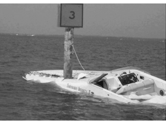
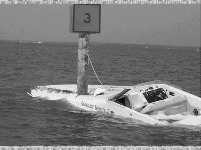
Navigation by gps
how not to do it
Found this wilst sorting out our garmin with software. What happens is the operator plots a course with the channel marker data rather than waypoint
data, sets the auto helm and goes down below. The gps steers the ploted course which are solid objects........with the results in the photo.
[Edited on 18-5-05 by mangogrooveworkshop]
Rescued attachment image008.jpg
|
|
|
|
|
marktigere1
|
| posted on 18/5/05 at 10:48 AM |
|
|
Is the name for real?
Cheers
Mark
|
|
|
colibriman
|
| posted on 18/5/05 at 11:39 AM |
|
|
nice and accurate though....!
need a bike engine? - www.colibriman.com

SVA ready Mk Indyblade possibly for sale.....if the offers good...!
|
NOTE:This user is registered as a LocostBuilders trader and may offer commercial services to other users
|


